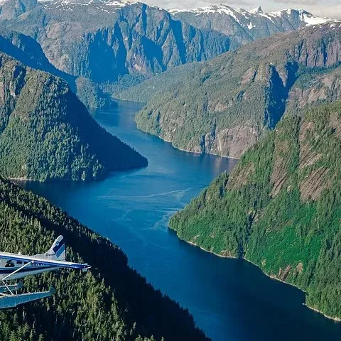
 Fastest
Guides
Language
EnglishCurrency
US dollar · $GetYourGuide converts to the currency you select here.
Guide · Map
Misty Fjords National Monument map: from Ketchikan to the fiords
Where the monument lies, how the water and the islands fit together, and the ways in from the Ketchikan docks, by floatplane, by boat or with a kayak.
Check availabilityfrom $349 · free cancellation possible
Editorial team, mistyfjordsflightseeing.comUpdated October 25, 2026Reading time about 6 minutes23 sources
Where the monument lies on the map
On a Misty Fjords National Monument map, Ketchikan sits on Revillagigedo Island, on the shore of the Tongass Narrows, and the monument covers the mainland to the east. The Alaska Marine Highway page for Ketchikan puts the town 22 miles west of the monument.1 Between them runs Behm Canal, the major inlet at the heart of the area, which is more than 50 miles long.2
The monument itself reaches from Behm Canal east toward the Canadian border. The proclamation describes fiords such as Rudyerd Bay and Walker Cove surrounded by high, cold lakes and mountains extending eastward to Canada.6 Over 2,200,000 acres were proclaimed in 1978, so the map shows a block of wilderness far larger than the town and its island.7
The two map panels on this page follow that geography. The first shows Ketchikan, Ward Cove, Behm Canal and the main bays of the monument; the second zooms in on Rudyerd Bay, with Punchbowl Cove, Punchbowl Lake, Nooya Lake and New Eddystone Rock. No flight path is drawn, because none of the tour listings publishes one.
Getting there
From the ship to the fiords
-
At the dock
Downtown or Ward Cove
Ward Cove is about 5.5 miles from downtown.8
-
Downtown
Berth 2 or Berth 3
Floatplane at Berth 2, boat cruise at Berth 3, 15 minutes early.
-
Leaving town
Tongass Narrows
Floatplanes take off from the channel in front of town.
-
Crossing
Behm Canal
The major waterway, more than 50 miles long.2
-
Arriving
Rudyerd Bay
The bay branches east off Behm Canal.3
The waterways that matter: Tongass Narrows and Behm Canal
Two channels explain the whole trip. The Tongass Narrows is the waterway in front of downtown Ketchikan, and the floatplane on this site's flight takes off from it and lands on it again at the end. Behm Canal wraps around Revillagigedo Island to the east and north, and the fiords of the monument open off its far shore.
Behm Canal is where most of the sights begin. The Forest Service calls it the major waterway through the heart of the area, travelled by boat or floatplane, with sightings of killer whales, porpoises, mountain goats and bears possible.9 New Eddystone Rock, a 237-foot lava plug, stands in the canal near the mouth of Rudyerd Bay.10
Rudyerd Bay branches east off Behm Canal, and Punchbowl Cove lies near its mouth.3 Nooya Lake is in the north arm of the bay, which opens off the east shore of the canal.11 On the map these places sit close together, and a short flight or a long boat day can take in several of them.
Distances
How far things are, in figures
| From | To | Distance or length |
|---|---|---|
| Ketchikan | The monument | 22 miles |
| Downtown | Ward Cove dock | About 5.5 miles |
| Behm Canal | End to end | More than 50 miles |
| Punchbowl Cove | Punchbowl Lake | 1.0-mile trail |
| Monument trails | All together | 20 miles |
Distances from the Alaska Marine Highway, the Ketchikan Visitors Bureau, the proclamation that created the monument and the Forest Service.1821213
Ways in
Three routes into the monument
Fastest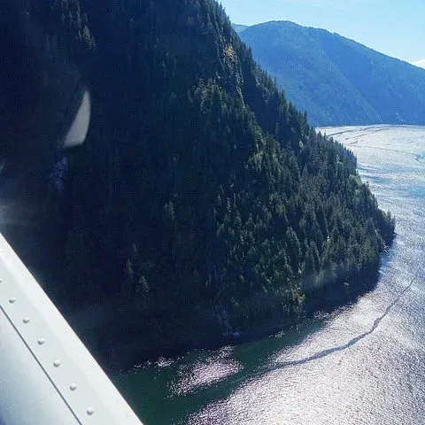 Water level
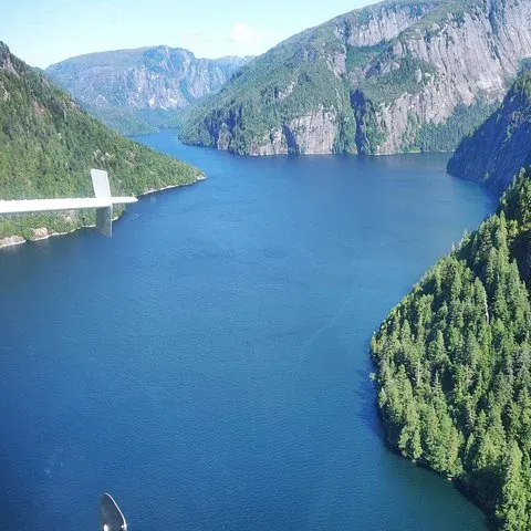 Most remote
Kayak drop-off
By boat from town
- Kayaks
- Rented in town
- Drop-off
- By a boat tour
- Stay
- Cabins or camping
Decision helper
Which way in suits your trip?
Start from the time you have
The floatplane
It takes 2 hours from Berth 2 back to Berth 2.
The boat cruise
It lasts 5.25 hours from Berth 3 downtown.
A kayak drop-off
Kayakers can rent in town and be dropped off by a boat tour.5
A Forest Service cabin
13 public recreation cabins lie inside the monument.13
Plan a transfer
Ward Cove is about 5.5 miles from downtown.8
Located east of Ketchikan, the 2.1 million-acre Misty Fjords National Monument is the largest wilderness area in the Tongass National Forest. There are no roads here!
How to get to the monument from Ketchikan
There are no roads into the monument, so every route starts on the water or in the air.4 Anyone asking how to get to Misty Fjords National Monument from Ketchikan has 3 real options for a day: a floatplane flight, a boat cruise, or a kayak trip with a drop-off by boat. For longer stays, the Forest Service cabins inside the monument are reached the same way.5
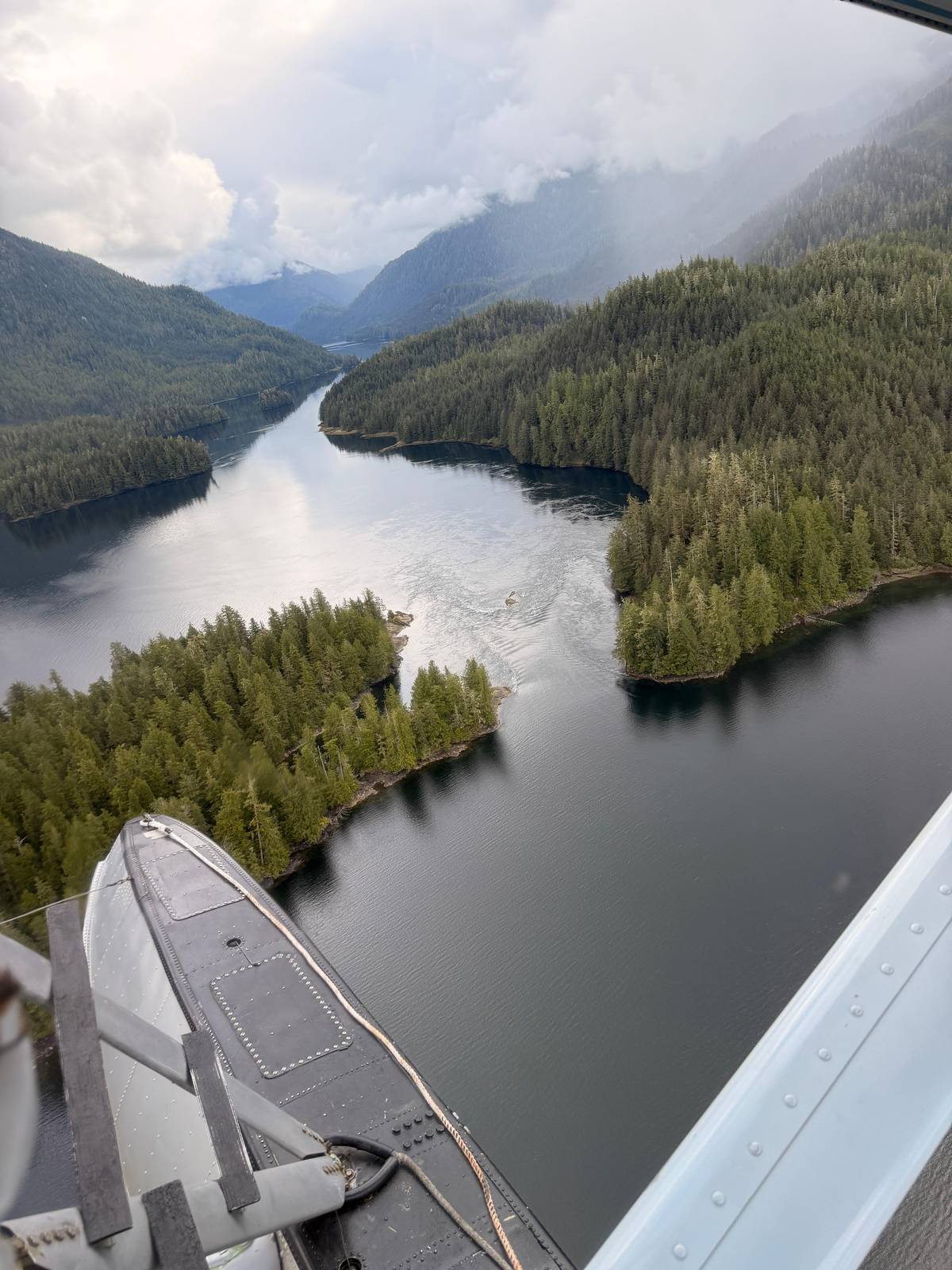
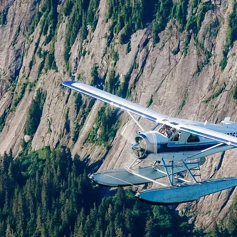
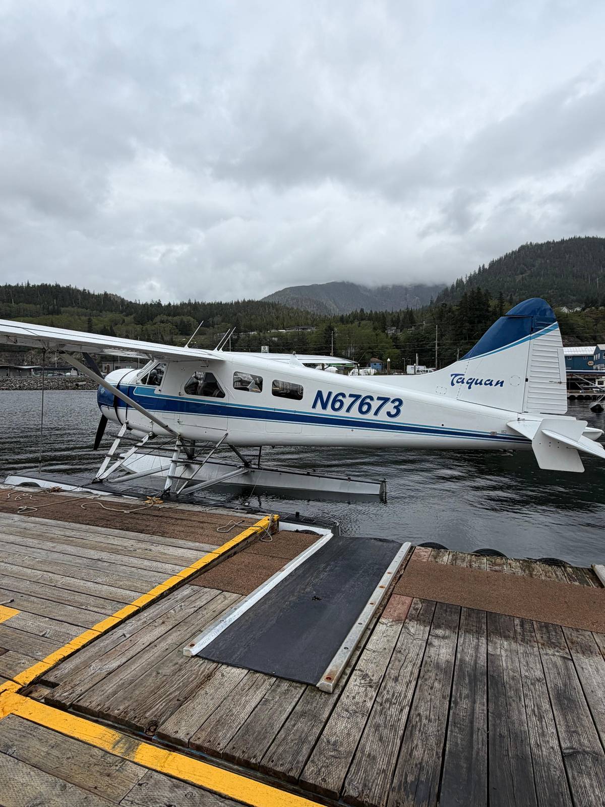
The floatplane is the fastest. This site's flight meets at Berth 2 downtown, 15 minutes before departure, and returns there after 2 hours in total, from $349. Floatplanes in Ketchikan are generally single-engine planes with floats instead of wheels, lined up at the harbor dock.14
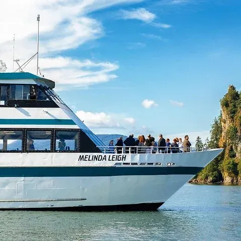
The boat takes most of a day. The cruise compared on this site leaves from Berth 3 downtown, asks you to arrive 15 minutes early and lasts 5.25 hours, from $232. Experienced kayakers can rent kayaks in town and be dropped off by a boat tour, and guided kayak trips to the fiords are available too.5
Map
From the Ketchikan docks to Rudyerd Bay
Where the floatplanes leave from, how far the fjords lie to the east, and the bays and lakes the flights pass over.
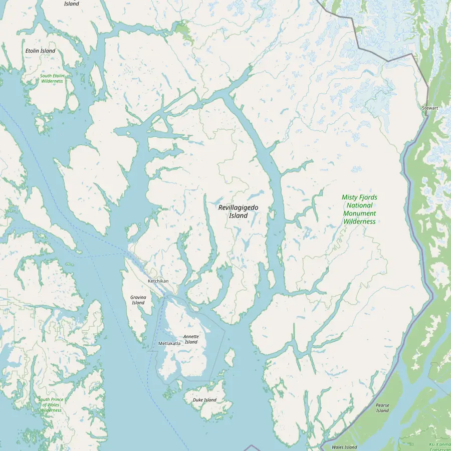 1Berth 2, Ketchikan2Ward Cove3New Eddystone Rock4Punchbowl Cove5Rudyerd Bay6Walker Cove
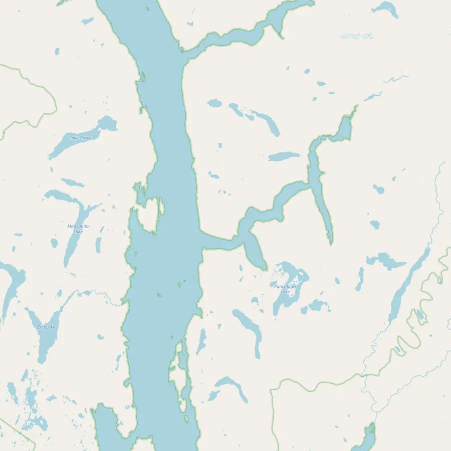 3New Eddystone Rock4Punchbowl Cove7Punchbowl Lake5Rudyerd Bay8Nooya Lake
- 1Berth 2, Ketchikan
Where the flight meets, by the bronze statue called The Rock; same-day tours are also sold at the Visitors Center here.15
In Google Maps ↗ - 2Ward Cove
Cruise berth outside town, some 5.5 miles from the downtown docks.8
In Google Maps ↗ - 3New Eddystone Rock
A plug of hardened lava standing 237 feet tall in Behm Canal.1016
In Google Maps ↗ - 4Punchbowl Cove
Near the mouth of Rudyerd Bay, reached only by boat or floatplane.3
In Google Maps ↗ - 5Rudyerd Bay
The bay that branches east off Behm Canal into the granite walls.3
In Google Maps ↗ - 6Walker Cove
A second fiord north of Rudyerd Bay, surrounded by high, cold lakes and mountains.6
In Google Maps ↗ - 7Punchbowl Lake
At the end of a 1.0-mile trail from the cove, with a three-sided shelter.12
In Google Maps ↗ - 8Nooya Lake
In the north arm of Rudyerd Bay, under the floatplanes' sightseeing path.1117
In Google Maps ↗
Checklist
Before you set off for the fiords
01
Know your start
- Your ship's dock: downtown or Ward Cove
- Your meeting time at Berth 2 or Berth 3
- A transfer if you dock at Ward Cove
02
Take with you
- The booking on your phone
- A rain jacket
- The area saved in your map app
Video
A seaplane flight from the Ketchikan waterfront into the wilderness
The video plays from YouTube only after you press play.
From your cruise dock to the meeting point
Ships tie up either at the downtown berths or out at Ward Cove, which the Visitors Bureau puts some 5.5 miles from the town center.8 On the first map panel, Ward Cove lies north-west of town along the Tongass Narrows. Both the floatplane and the boat compared here start downtown, so a Ward Cove passenger needs a transfer into town first.
Downtown, the meeting points are at the cruise berths. The flight meets at Berth 2, next to the Ketchikan Visitors Center, by the bronze statue called The Rock, and the boat meets at Berth 3 downtown. Same-day seats can also be bought at the Visitors Center on Berth 2 and at the dock kiosks.15 Arrive early either way, since the van or the boat will not wait long.
Allow for the unexpected. The Ketchikan Visitors Bureau warns that last-minute changes to the docking schedule sometimes occur.18 Check where your ship will tie up on the morning you arrive, and if it moves to Ward Cove, build the transfer into your plan before you go ashore.
Distances and scale on the ground
The numbers on the map are modest, the landscape is not. The town is 22 miles from the monument, but the monument covers 2,142,243 acres of designated wilderness, the largest on the Tongass National Forest.119 Inside it, the Forest Service counts 13 public recreation cabins, 5 shelters and 10 trails with 20 miles of hiking in total.13
That is very little infrastructure for so much land. The Punchbowl Lake trail, one of the few, climbs 1.0 miles from the head of Punchbowl Cove to the lake, starting easy and turning steep.12 The lake looks tiny from a floatplane, which gives a sense of how far the granite and forest really reach.
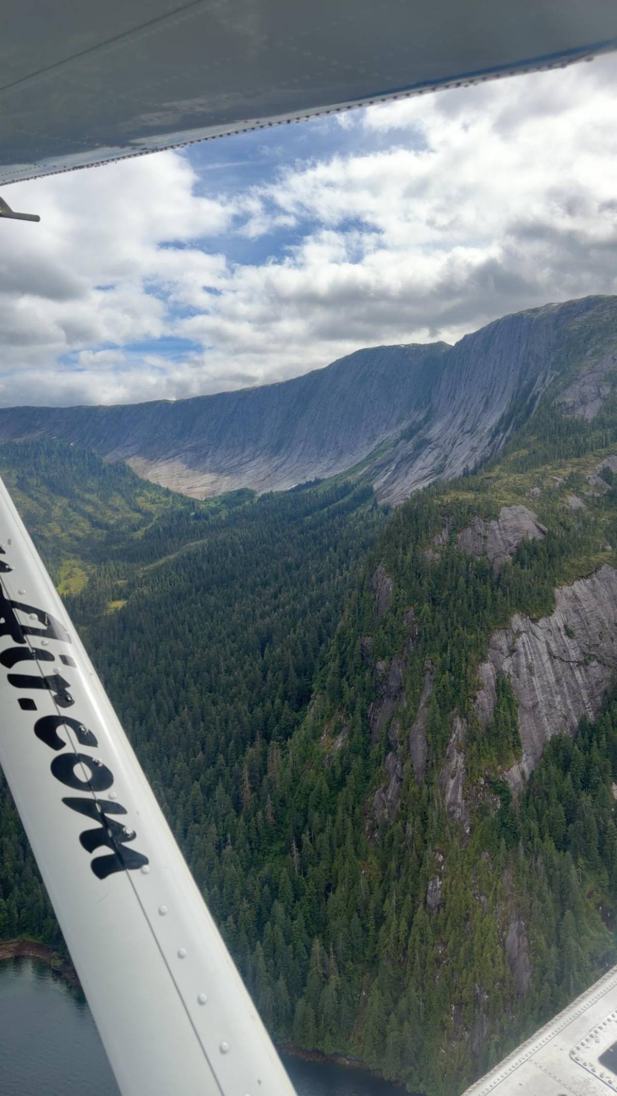
From the air, scale is the main impression. Cliffs rise for thousands of feet out of the fiords that the ice carved about 17,000 years ago.20 A map can show where things are; only a flight or a boat day shows how high the walls are above the water.
Landmarks you can match to the map from the air
The easiest landmark to find is New Eddystone Rock, a single 237-foot plug of lava standing in Behm Canal.10 Once you have it, the mouth of Rudyerd Bay is close by to the east, and the bay's long arm leads into the walls. On the map panel of Rudyerd Bay, the rock is the pin standing alone in the open water of the canal.
Punchbowl Cove is the next one to look for, near the mouth of the bay.3 Its north side is a gray granite cliff, and the cliffs at its head are blackish basalt, so the cove shows pale and dark rock side by side.2122 Punchbowl Lake sits just above the cove, at the end of its 1.0-mile trail, and from a plane it looks like a small dark pool.12
Further north, Nooya Lake lies in the north arm of Rudyerd Bay, and Walker Cove opens off the mainland shore beyond it.116 If the pilot names a lake or a bay, find it on the map afterwards; matching what you saw to the map is a good way to keep the flight in your memory once the photos all look like water and rock.
Planning a trip with the map
Use the map to match your time to a route. With a short port day, the flight from Berth 2 covers the distance to the fiords and back in 2 hours. With a full day, the boat from Berth 3 reaches New Eddystone Rock and Rudyerd Bay at water level, passing Saxman and Annette Island on the way.
Use it for the weather too. Cloud that sits on the high ground east of Behm Canal can stop flights while the water below stays calm, and September in Ketchikan averages 18 days on which 2.5 mm or more falls.23 Check the forecast for the mainland as well as for town before you commit.
Use the Google Maps button under the map to open the area on your phone, and save it before you go. Inside the monument there are no roads, and your view from a plane window will make more sense if you know which way Behm Canal runs and where the bays open off it.
Ready to fly
Book a window seat over the fiords
Pick a departure that fits your ship, then meet the van at Berth 2.


You ask,we answer.
Where exactly is the monument?
On the mainland east of Ketchikan. Ketchikan lies 22 miles west of it, on Revillagigedo Island across Behm Canal.1
Can you drive there?
No. There are no roads into the monument; visitors arrive by boat, floatplane or kayak.45
Where does the floatplane leave from?
Berth 2 in downtown Ketchikan. Meet 15 minutes before the tour next to the Ketchikan Visitors Center, by the bronze statue called The Rock.
Where does the boat cruise leave from?
Berth 3 downtown. Arrive 15 minutes before departure; the cruise lasts 5.25 hours.
How far is Ward Cove from downtown?
About 5.5 miles. Ships at Ward Cove need a transfer into town before a downtown tour.8
How long is Behm Canal?
More than 50 miles. The proclamation calls it the major inlet at the heart of the area.2
Can I kayak into the fiords?
Yes, with planning. Guided kayak trips are available, and kayakers can be dropped off by a boat tour.5
Sources
Sources and evidence
- 1Alaska Marine Highway System, Alaska DOT&PFKetchikan community page↩
- 2President Jimmy Carter, Proclamation 4623Proclamation 4623: Misty Fiords National Monument, December 1, 1978↩
- 3US Forest Service, Tongass National ForestPunchbowl Lake Trailhead↩
- 4Travel Alaska (State of Alaska), archived pageTop Things To Do in Ketchikan: Visit Misty Fjords National Monument↩
- 5Alaska Department of Fish and GameKetchikan: Misty Fjords National Monument↩
- 6President Jimmy Carter, Proclamation 4623Proclamation 4623: Misty Fiords National Monument, December 1, 1978↩
- 7US Forest ServiceMisty Fjords National Monument↩
- 8Ketchikan Visitors BureauWelcome Cruise Travelers↩
- 9US Forest ServiceMisty Fjords National Monument↩
- 10US Forest Service, Alaska RegionSculptures in Granite: A Guide to the Geology and Glacial History of Misty Fjords National Monument (R10-RG-243)↩
- 11US Forest Service, Tongass National ForestNooya Lake Shelter Site↩
- 12US Forest Service, Tongass National ForestPunchbowl Lake Trailhead↩
- 13US Forest ServiceMisty Fjords National Monument↩
- 14Travel Alaska (State of Alaska), archived pageTop Things To Do in Ketchikan: Visit Misty Fjords National Monument↩
- 15Ketchikan Visitors BureauWelcome Cruise Travelers↩
- 16US Forest Service, Alaska RegionSculptures in Granite: A Guide to the Geology and Glacial History of Misty Fjords National Monument (R10-RG-243)↩
- 17US Forest Service, Tongass National ForestNooya Lake Shelter Site↩
- 18Ketchikan Visitors BureauWelcome Cruise Travelers↩
- 19US Forest ServiceMisty Fjords National Monument↩
- 20US Forest ServiceMisty Fjords National Monument↩
- 21US Forest Service, Alaska RegionSculptures in Granite: A Guide to the Geology and Glacial History of Misty Fjords National Monument (R10-RG-243)↩
- 22US Forest Service, Alaska RegionSculptures in Granite: A Guide to the Geology and Glacial History of Misty Fjords National Monument (R10-RG-243)↩
- 23↩
Keep reading